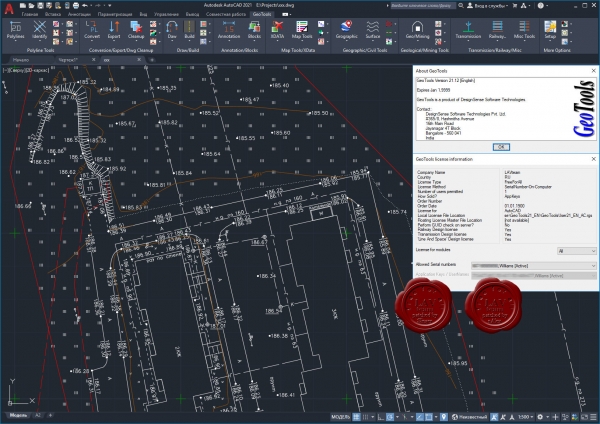
GeoTools is an addon program for AutoCAD and Bricscad which provides you with a number of useful productivity tools that are designed exclusively for the geographic data user. It is a heterogenous collection of CAD tools that are useful for users in the mapping, surveying, GIS, facilities planning, real estate and infrastructure management industry.  GeoTools is a time-saver productivity tools built for geo-data using CAD users who want to work smart and not hard. In the AutoCAD version of GeoTools, there are a large number of AutoCAD Map tools as well that making working with object data a breeze.
GeoTools functions are arranged in easily categorized pull-down menus, toolbars and also as tabbed ribbons in AutoCAD 2013 and later versions. Some of the borad category of tools you will find in GeoTools are Polyline, Annotation, Drawing Cleanup, Digitizing, AutoCAD Map, Inquiry and so on. 什么是GeoTools?
GeoTools是一种地理数据应用程序,可用于查看,创建,修改,分析和报告本质上为地理的CAD数据。如果您的业务性质是GIS数据创建,测量,制图,设施管理,基础设施,景观开发,城市规划或类似项目,则GeoTools可以为您带来不同,并提高您的生产率。
GeoTools是非常方便的省时工具,用于在CAD环境中进行GIS数据准备和编辑。
为什么选择GeoTools?
提高操作员效率
大大减少了操作员错误
通用的与地理数据相关的CAD任务自动化
广泛的功能–民事工具,地图数据清理,Google Earth集成,测量数据处理等。
高级数据管理–将dwg转换为数据库
适用于AutoCAD / BricsCAD的GeoTools V21软件
GeoTools是在AutoCAD和BricsCAD内部运行的轻量级地理数据CAD软件。 GeoTools是非常方便的省时工具,用于在CAD环境中进行GIS数据准备和编辑。来自AEC和其他行业的各种CAD用户也使用了地理数据,因此GeoTools是当今大量CAD用户必备的CAD工具。
How does it compare with AutoCAD Map / Civil 3D / Google Earth? GeoTools offers more than 60% of the functions that are found in AutoCAD Map and which are commonly required by majority
(90%) of users.
Data Cleanup & Optimization:All data cleanup and optimization techniques found in AutoCAD Map like polyline vertex weeding, densification, fixing of
overshoots and under-hangs, intersection cleanup based on snapping etc. are handled by GeoTools in an efficient manner.
Independent snapping of points in 2d and/or 3d is possible and all operations preserve all attached entity data like XDATA, object
data, attributes etc.
Topology Building:Building meaningful data from disconnected ones is always one of the goals of GIS. GeoTools has tools to build closed polygons
from disconnected but touching edges, create area annotations, attached database and export to Excel.
Geographic Coordinates conversion:GeoTools offers complete coordinate conversion from UTM, Transverse Mercator, Albers and Lambert systems to Lat-Long and
vice-versa, complete with datum shift handling etc.
Google Earth Interaction (Export/Import):GeoTools offers complete integration with Google Earth and allows KML/KMZ data import and export of vector data. All this is
functionality that is found in Civil 3D software only. It is also possible to extract viewport image from Google Earth and bring it
into CAD with geo-referencing.
Surveying & Terrain modeling:For surveying professionals and terrain designers, GeoTools offers easy ability to create cross-sectional profiles, longitudinal
sections, volume calculations, TIM grid creation, drawing of graded lines, traverse adjustments and so on.
Mining & Geology:GeoTools also has a small section called Geological and Mining which is under development and in its initial design phases.
Planning & Visualization Tools:GeoTools intends to add a set of planning and visualization tools for city and neighborhood planning, zoning analysis, flight path
and buffer zone modeling and so on.
购买后,将显示帖子中所有出售内容。
若发现会员采用欺骗的方法获取财富,请立刻举报,我们会对会员处以2-N倍的罚金,严重者封掉ID!
此段为出售的内容,购买后显示