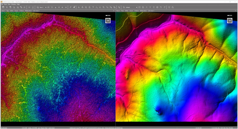
LiMON UAV 是一种强大而高效的工具,用于快速便捷的点云分类、点云编辑和创建衍生产品,尤其是来自无人机调查的产品。 LiMON UAV is a powerful and efficient tool for fast and convenient point cloud classification, point cloud editing and creation of derived products especially from UAV surveys.
数据显示 - 点云显示模式:RGB、强度、高程、分类、混合、文件颜色
构建和显示 3D 表面 - 基于点云创建 3D 表面
- 以实体、RGB、强度、高程、分类、混合、文件颜色模式显示曲面
- 显示曲面线框
- 调整曲面的细节渲染范围


显示 3D 模型 - GML, OBJ, 3DS, DAE, FBX, IFC
- 以模式显示模型:原始(也带有纹理),均匀,高级和三角形网格
- 变换加载模型:平移、旋转和缩放
手动点云分类 - 定义自己的分类方案
- 矩形、形状和走廊分类
- 线上方和下方的分类
- 使用形状标记进行分类
- 按活动 Z 分类
- 特定强度范围内的分类


自动点云分类 - 自动对地面进行分类
- 建筑物自动分类
- 植被自动分类
- 编辑所有分类模式的参数
与利蒙服务器合作 - 远程访问 (LAN/WAN) 由 LiMON 服务器共享的数据
- 项目选择
- 根据密度水平选择数据显示
- 元数据读取
- 从利蒙服务器显示项目的范围
- 激光雷达数据的下载和可视化


维基系统支持
栅格数据 - JPG, JPEG
- JP2, J2K
- 蒂夫,蒂夫
- 电子电气工程


配置 文件 - 所选视图中的配置文件
- 折线轮廓定义
- 对称轮廓定义
- 固定宽度/长度
- Z 比例因子
- 动态移动
Document creating module - Dimensioning based on point clouds (distance, height, altitude point, the angle of inclination)
- Page size/color definition, output scale, template
- Setting out of the output scale
- Dimension lines and fonts editing
- Insert and edit names nad grid lines
- Choice global/relative coordinates
- Saving as a image file (JPG, PNG, BMP, TIF, TIFF)
- Export to DXF format (as an integrated raster)


Vector data - Point markers
- Line markers
- Shape markers
- Circle markers
- Relative height markers
- Markers save / load (KML, SHP, TXT)
Measurements 

Point cloud snapping - Snapping to the point cloud (on/ff)
- Precision drawing in the profile view
Coordinate systems - Full EPSG coordinates support
- Point cloud coordinates system transformation


相机视图
剪裁盒 

无人机 - 点云对齐
- Wpasowanie GCP
- 超额覆盖区域的分类。
- 为点云着色
- 质量管理
高度型号 DTM帝斯曼nDSM信息交换所机制等高线
购买后,将显示帖子中所有出售内容。
若发现会员采用欺骗的方法获取财富,请立刻举报,我们会对会员处以2-N倍的罚金,严重者封掉ID!
此段为出售的内容,购买后显示